Task II.K: National Airspace System
- Lesson Overview
- Instructor Notes
- Lesson Details
- Airspace classification (PHAK 15-1, AIM 3-1-4)
- Class A (PHAK 15-2)
- Class B (PHAK 15-2)
- Class C (PHAK 15-2)
- Class D (PHAK 15-2)
- Class E (PHAK 15-2)
- Class G [PHAK 15-2]
- Special VFR [14 CFR 91.157]
- Transponder requirements [14 CFR 91.215(d)]
- Airspeed restrictions [14 CFR 91.117]
- Special use airspace (PHAK 15-3,4)
- Other airspace areas (PHAK 15-4-7)
- Conclusion
- ACS Requirements
Lesson Overview
- Objective
-
The student should develop knowledge of the elements related to the National Airspace System.
- Reference
-
-
14 CFR Part 91 PHAK Chapter 15 AIM-3
-
Airspace AOPA Airspace Flashcards
-
- Key Elements
-
-
Entry requirements
-
Communication requirements
-
Weather requirements
-
- Elements
-
-
Airspace classes
-
Special Use Airspace
-
Other airspace areas
-
- Equipment
-
-
White board
-
Markers
-
References
-
- Schedule
-
-
Discuss objectives
-
Review material
-
Development
-
Conclusion
-
- Instructor Actions
-
-
Discuss lesson objectives
-
Present lecture
-
Questions
-
Homework
-
- Student Actions
-
Participate in discussion Take notes
- Completion Standards
-
The student is able to differentiate between the different airspaces and their respective weather minimums and requirements.
Instructor Notes
- Attention
-
Each type of airspace is like a different country. Each type of airspace has its own controllers or rulers, its own rules for those in their ‘territory,’ and its own benefits or services which are provided to those within its borders. Borders are drawn and there are requirements and permission necessary to enter certain airspaces (e.g. Passport).
- Overview
-
Review Objectives and Elements/Key ideas
- What
-
Airspace is defined as, “the portion of the atmosphere above a particular land area, especially above a nation.” The atmosphere above the United States is divided into several sectors, or classes and in each different airspace class, specific rules apply.
- Why
-
Different airspaces have been defined to efficiently manage the large amount of air traffic that traverses the sky each day. In order to fly from place to place a pilot must know the rules and requirements regarding airspace.
Lesson Details
The National Airspace System (NAS) is the airspace, navigation facilities and airports of the United States along with their associated information, services, rules, regulations, policies, procedures, personnel and equipment. It includes components shared jointly with the military. It is one of the most complex aviation systems in the world and services air travel in the United States and over large portions of the world’s oceans.
Airspace classification (PHAK 15-1, AIM 3-1-4)
-
Regulatory
-
Class A, B, C, D, E
-
Restricted and prohibited
-
-
Non-regulatory
-
MOAs, warning areas, controlled firing areas, alert areas
-
-
Four types
-
controlled
-
uncontrolled
-
special use
-
other
-
Class A (PHAK 15-2)
Airspace from 18,000’ MSL up to and including FL600. Includes airspace overlying the waters within 12 NM of the coast of CONUS and Alaska.
-
All flights must be conducted under IFR:
-
IFR rated and equipped airplane (DME)
-
Instrument rated pilot
-
Requires ATC clearance (IFR flight plan)
-
Class B (PHAK 15-2)
Generally, the airspace from the surface up to 10,000’ MSL surrounding the busiest airports. Consists of a surface area and two or more layers (upside down cake)--designed to contain all instrument procedures. Separation services provided.
-
Speed restrictions: inside a layer 250 knots, under a shelf 200 knots.
-
Entry requirements: ATC clearance.
-
Required equipment: two-way communication, 4096-code transponder with altitude reporting capability.
-
Pilot requirements: a private pilot certificate, except student pilots and recreational pilots seeking private pilot certification that have an endorsement [14 CFR 61.95].
-
Some Class B airports prohibit student operations—check list.
-
Weather requirements: 3 SM visibility, clear of clouds.
-
Chart depiction: solid blue line
VFR corridor
Small area that cuts through Class B airspace where pilots can operate VFR without clearance.
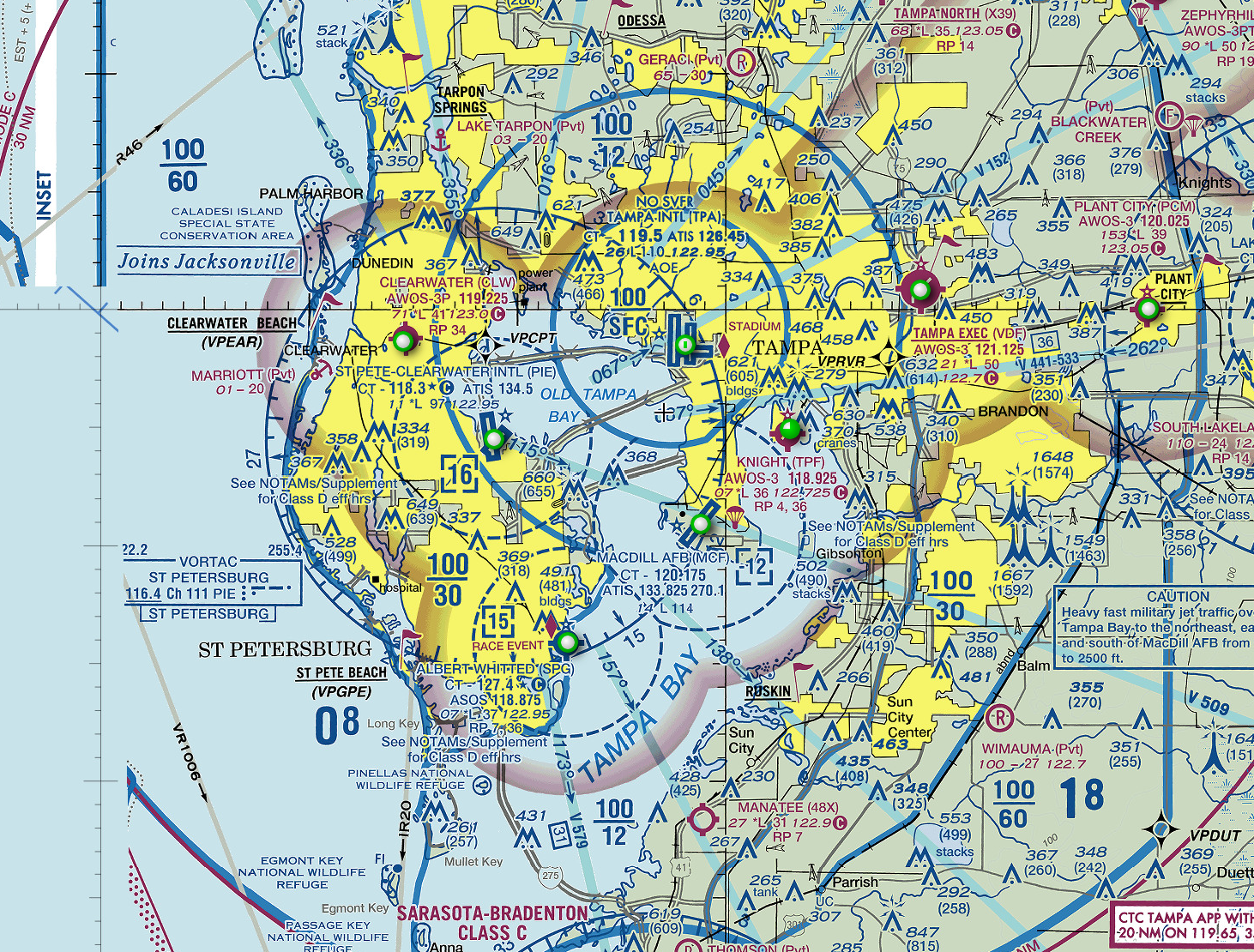
Class C (PHAK 15-2)
Generally extends from surface to 4,000’ above the airport elevation. Airports have an operational control tower and are serviced by a radar approach control. Airport must have a certain number of IFR operations or passenger enplanements. IFR and participating VFR traffic separation, VFR traffic advisories on a workload permitting basis.
-
Typically 5 NM surface area radius (surface to 4,000’ AGL), 10 NM outer circle (1,200’-4,000’ AGL).
-
Speed restrictions: within 4 NM radius of primary airport 200 knots.
-
Entry requirements: two-way communication
-
Required equipment: two-way radio, transponder with altitude reporting capability.
-
Weather requirements: 3 SM visibility, 1,000’ above, 500’ below, 2,000’ horizontal.
-
Chart depiction: solid magenda line
-
Mode C veil: 30 NM radius that requires a transponder with altitude encoding capability
Class D (PHAK 15-2)
-
Generally extends from surface to 2,500’ above the airport’s elevation.
-
Normally has a 4 NM radius but changes depending on needs.
-
Part time operational control tower—Class D when tower is in operation, Class E otherwise.
-
Airspace configured to meet operational needs and instrument procedures of the area.
-
Speed restrictions: 200 knots.
-
Entry requirements: two-way communications.
-
Required equipment: two-way radio.
-
Weather requirements: 3 SM visibility, 1,000’ above 500’ below, 2,000’ horizontal.
-
Chart depiction: dashed blue line.
Class E (PHAK 15-2)
Controlled airspace that is not designated A, B, C, or D. IFR separation provided, VFR advisories upon request and on a workload permitting basis.
Unless otherwise depicted, begins at 14,500’ MSL, up to but not including 18,000’ MSL, overlying CONUS, Alaska, the waters 12 NM from the coast, and DC. Extends upward from either the surface or a designated altitude to the overlying or adjacent controlled airspace.
-
Speed restrictions: 250 knots below 10,000’ MSL.
-
Entry requirements: none for VFR.
-
Weather requirements: below 10,000’ 3SM visibility, 1,000’ above, 500’ below, 2,000’ horizontal; at or above 10,000’ MSL 5 SM visibility, 1,000’ above, 1,000’ below, 1,000’ horizontal.
-
Chart depiction: depends on beginning altitude…
-
Dotted magenda line—starts at surface.
-
Ombre magenda—starts 700’ above the surface.
-
Ombre blue—starts 1,200’ or greater above the surface.
-
Low altitude airway system
Unless otherwise specified, extend upward from 1,200’ MSL up to, but not including, 18,000’ MSL. Floor over mountainous terrain may be above 1,200’ MSL.
-
Connects one navaid to another.
-
Victor Airways—VOR to VOR; usually 8 NM wide.
-
Extension to surface area
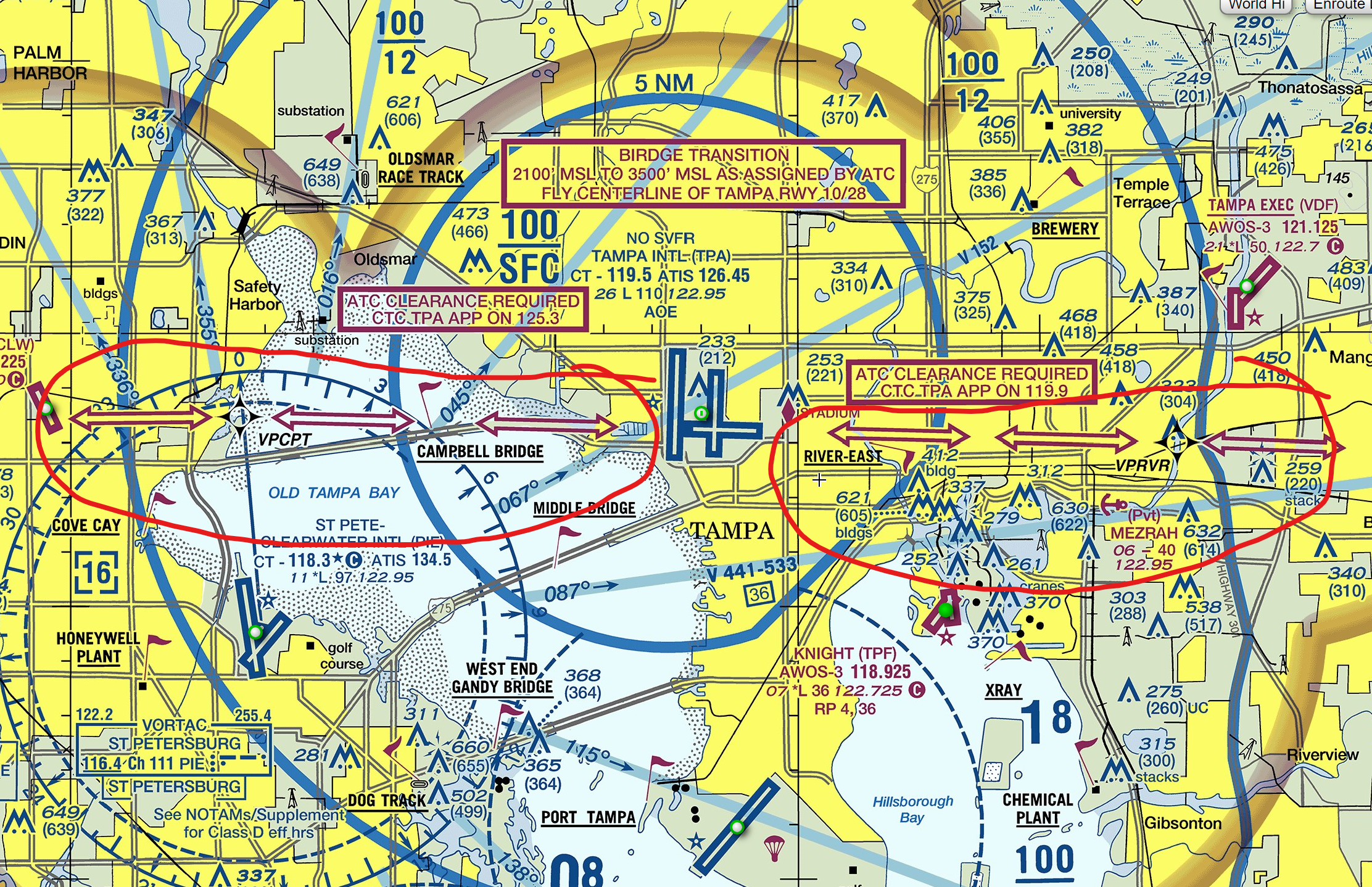
Class E areas can serve as extensions to Class B, C, D surface areas designated for an airport—provide controlled airspace to contain standard instrument approach procedures without imposing a communications requirement on VFR operating pilots. (e.g. TPA)
Transition Airspace
Allows IFR traffic to remain in controlled airspace while transitioning between enroute and airport environments. Begin at either 700’ AGL or 1,200’ AGL.
IFR Control Purposes
En route domestic areas—provide controlled airspace in those areas where there is a requirement to provide IFR en route ATC services but the Federal Airway System is inadequate. Airspace areas that extend upward from a specified altitude as an en route domestic areas.
Offshore airspace areas—provide IFR en route ATC services within which the US is applying domestic procedures. Airspace areas that extend upward from a specified altitude to, but not including, 18,000’ MSL, to provide controlled airspace beyond 12 NM from the coast.
Class G [PHAK 15-2]
Uncontrolled airspace; extends from the surface to the base of the overlying Class E airspace. ATC provides VFR advisories upon request on a workload permitting basis. Weather requirements: based on day/night operations and altitude
-
Below 1,200’ AGL, day—1 SM visibility, clear of clouds.
-
Below 1,200’ AGL, night—3 SM visibility, 1,000’ above, 500’ below, 2,000’ horizontal.
-
Below 10,000’ MSL, day—1 SM visibility, 1,000’ above, 500’ below, 2,000’ horizontal.
-
Below 10,000’ MSL, night—3 SM visibility, 1,000’ above, 500’ below, 2,000’ horizontal.
-
At or above 10,000 MSL—5 SM visibility, 1,000’ above, 1,000’ below, 1 SM horizontal.
Special VFR [14 CFR 91.157]
During the day, SVFR requires
-
ATC clearance
-
1 SM visibility
-
Clear of clouds
At night, the pilot must be instrument rated and the aircraft must be IFR equipped.
|
☑️
|
Some airports have SVFR restrictions. |
Transponder requirements [14 CFR 91.215(d)]
-
At or above 10,000’ MSL, excluding airspace below 2,500’ AGL.
-
Within 30 NM of a Class B primary airport below 10,000’ MSL.
-
Within and above all Class C airspace up to 10,000’ MSL.
-
Within 10 NM of certain designated airports, excluding airspace which is both outside the Class D surface area and below 1,200’ AGL.
-
Flying into, within, or across the ADIZ.
Airspeed restrictions [14 CFR 91.117]
-
Below 10,000’ MSL 250 knots
-
Below 2,500’ AGL within 4 NM of the Class C, D primary airport 200 knots
-
Underlying Class B airspace designated for an airport or in a VFR corridor through Class B airspace 200 knots
Special use airspace (PHAK 15-3,4)
Prohibited areas
Airspace within which flight is prohibited. Established for security or other purposes associated with national welfare. Published in Federal Register and depicted on aeronautical charts.
Restricted areas
Flight of aircraft is not wholly prohibited but is subject to restrictions. Denotes unusual and often invisible hazards to aircraft (artillery firing, aerial gunnery, guided missiles, …) Published in Federal Register and depicted on aeronautical charts.
Cannot enter without permission from the controlling agency. ATC will allow aircraft to operate in the airspace if it’s inactive and will ensure that the aircraft avoids the restricted area if the airspace is active.
Warning areas
Airspace extending from 3 NM outward from the coast. May be hazardous to nonparticipating aircraft (similar activities to those in restricted area). Depicted on aeronautical charts.
Purpose: to warn nonparticipating traffic of potential danger.
Military operation areas (MOA)
Airspace established to separate certain military training activity from IFR traffic. No restrictions against VFR operating pilots in these areas, but be alert. Depicted on aeronautical charts.
IFR traffic may be cleared through the MOA if IFR separation can be provided. Otherwise, IFR traffic will be rerouted.
Alert areas
Advise pilots that high volume of pilot training or unusual aerial activity is taking place. Depicted on aeronautical charts.
Controlled firing areas
Contains activities that could be hazardous to nonparticipating aircraft if not conducted in controlled environment. Not depicted on a chart and do not cause nonparticipating traffic to change flight path—activities must be suspended when a spotter aircraft, radar, or ground lookout position indicates that nonparticipating traffic might be approaching the area.
Other airspace areas (PHAK 15-4-7)
Airport advisory areas
Area within 10 SM of an airport with a non-operating control tower, but where an FSS is located.
FSS provides advisory service to arriving and departing traffic.
Military training routes
Allow military to conduct low-altitude, high-speed training. IFR routes above 1,500’ AGL, VFR routes below 1,500’ AGL. Identified on sectional charts by the designation “IR” or “VR.”
Temporary flight restrictions (TFR)
Established to…
-
Protect persons and property in the air or on the surface from an existing or imminent hazard
-
Provide a safe environment for disaster relief aircraft operation,
-
Prevent an unsafe congestion of sightseeing aircraft above an incident/event which may generate a high degree of public interest
-
Protect declared national disasters for humanitarian reasons in Hawaii
-
Protect the President, VP, or other public figures
-
Provide a safe environment for space agency operations.
-
FDC NOTAM issued to designate TFR. Begins with phrase “FLIGHT RESTRICTION” followed by location, effective time period, area defined in SM, and altitudes affected for temporary restriction.
-
Includes FAA coordination facility and telephone number, reason for restriction, and other appropriate information
Check before flying!
Parachute jump areas
Published in chart supplement. Frequently used parachute jump sites are depicted on sectional charts.
Published VFR routes
Established for transitioning around, under, or through complex airspace. VFR flyway, VFR corridor, Class B airspace, VFR transition route, terminal area VFR route.
Found on VFR terminal area planning charts.
Terminal radar service areas (TRSA)
Areas where participating pilots can receive additional radar services. Provide separation between all IFR operations and participating VFR traffic. Voluntary but encouraged participation. Primary airport(s) within TRSA is Class D airspace. The remaining area overlies other controlled airspace—normally Class E at 700’ or 1,200’ AGL—and established to transition to/from the en route terminal environment.
Chart depiction: solid black line, altitudes for each segment. Depicted on VFR sectional charts and terminal area charts. Class D portion depicted with blue segmented line.
National security areas
Airspace of defined vertical/lateral dimensions, established when increased security and safety of ground facilities is required. Pilots requested to voluntarily avoid flying through depicted areas, and flight may be temporarily prohibited when necessary.
Conclusion
Overview of the differences based on airspace and traffic.
ACS Requirements
To determine that the applicant exhibits instructional knowledge of the elements of the national airspace system by describing:
-
Basic VFR weather minimums—for all classes of airspace.
-
Airspace classes—their operating rules, pilot certification, and airplane equipment requirements for the following:
-
Class A.
-
Class B.
-
Class C.
-
Class D.
-
Class E.
-
Class G.
-
-
Special use airspace (SUA).
-
Temporary flight restrictions (TFR).